David Dezendorf

Friday night I received notice that a plane crash with two deaths happened at my old school. I checked LiveATC for recordings and determined I most certainly knew who perished due to who was making radio calls around that time on the CTAF. My mother and a couple friends text me within minutes of the fire starting too, to let me know something happened, so that didn’t help my mental state for the evening.

It has officially come out that David Dezendorf – one of the CFIs at my old school was one who died in the crash. I will not speculate or blame or anything at all on what happened, I am by no means an expert in anything related to accidents.

I really liked every interaction I had with David. When I was sitting at the FBO waiting for my main instructor Gene, we always had great conversations while he was waiting for his students. He was the CFI who completed and approved my Checkride stage checks, so I have his signature in my logbook.

This kind of has me shook a little bit and wanting to do more risk assessment. I haven’t flown in a year due to fears of being in a cockpit with an instructor and covid exposures. I also lost interest for a bit while studying for my instrument rating. I didn’t have a great experience learning from an instructor on Zoom, and got distracted with a new job around the same time as the ground school.

I’m debating on taking some more time off for a bit – sticking to simulators and such. I’m sure when I touch a yoke again next time it’ll be fine. I’m thirty-four years old, I’m in no rush to get a million hours and start a career or anything – so taking time off is really easy.

Rest in Peace David – I’m sorry to Monadnock Aviation that this happened as well.

Other references:

October 17, 2021 – Back above Keene

Tyrel hugging Jill in front of N43337 after landing.

It’s my brother’s wedding weekend and he asked me to take him and his new father-in-law flying. On October 16th I get to the airport, very well knowing that it’s still too foggy for my 8am-10am flight that I was about to cancel in person. I still went in, because I haven’t seen Beth in almost a year and wanted to say hi. We caught up, talked about how I’ve been going to Monadnock Aviation since I was in college – after my first flight on March 17, 2010! I called Levi and told him that we weren’t flying, so he should just go finish getting ready for his wedding at 11:30.

The next day I had booked for my mother to go up the first time with me. We get to the airport at 9:55 and the FBO is locked up, Uhhhh. I email/text some people and no one knows how to get a hold of the desk attendant. We had apparently JUST missed David, one of the CFIs, who was getting into N44836 with a student I presume. So we waited a bit and it seems he was called away to do some fueling with the fuel truck. No fault of his at all, Sundays can get a little rough with only one person being at the FBOs desk.

We finally grab the book and keys and I go out and preflight. I’m in N43337 today, my favorite plane. I’m even wearing my “WARRIOR 337” shirt I got for soloing, for good luck! Preflight was easy as usual, once you’ve done it a hundred times in the same plane, you know what you’re looking for from the checklists.

I waved to mom and Lauren to come over and we got in, I showed mom and Lauren how to set up the headphones and get into the back seat. Following a safety briefing we were off!

We taxied over from the Northwest ramp (The FBO area) to the East ramp and I did my run up there, the winds were 340° at 7kts gusting to 17, so the other planes were using runway 32. Waited around a bit for a radio check, the PTT button was sticky and no one was replying to my ask for radio checks, even though there were a few planes around, oh well.

We took off on runway 32 after waiting in line (it was busy today, wow!) and I did a lap around the pattern. It was not clean, I haven’t flown in just over two months, and we had the added weight of a back passenger, so I was a little nervous the first pattern loop. But I will always do one pattern loop with a new passenger – just to give them a chance to bail out!

I’m not fond of runway 32, it has a high hill over Marcy Hill in Swanzey, NH and it always throws me off (probably because I have like 300 landings on runway 02 and maybe 15 on runway 32). The landing was fine, Lauren was taking pictures from the back and my mom said it was “wicked smooth, and you barely even felt the tires hit, I thought it was great, especially with the wind and everything” which as a first time passenger in a “oh my god I didn’t know it was quite this small” airplane, I feel good about!

We then taxied back to 32, and took off again, this time it was a west departure out to Spofford Lake and over my mom’s house in Chesterfield. I probably should have headed to Brattleboro first after Spofford. Had I done this, we would have been in position to fly Brattleboro, VT north to Putney, VT west of the Connecticut River and my mom would have gotten a MUCH nicer view of her house. Instead we flew over the lake and through a little valley over Westmoreland and went south along the river.

At one point I saw a dark cloud above and said “Okay we’re about to go under a dark cloud, I’ll try to avoid it but it might get turbulent”, so mom and Lauren would know to hold on and probably 10 seconds later the plane went “woomp” down a bit because of turbulence – so they were prepared. After that small cloud we found a tiny patch of clean air and I turned to the right a little bit above Exit 3 and headed north again towards moms house, staying a little bit west of the river. I paralleled I91 again for a minute or two and then we got in line that I could fly close enough to mom’s house that she could see it.

After that fun bit we headed back, directly over Spofford Lake for some more sights, and onward to KEEN.

We flew over Yale Forest, and I saw a cool cliff face I had never seen before – as we were entering RWY32 on a 45° entry. Entered the pattern and found myself VERY high (900msl at at 488msl airport) on final, on a 4000′ runway with a displaced threshold so I executed a go around there. I probably could have made it, but with the wind and avoiding Marcy Hill, I figure it’s always safe to Go Around.

The next loop I had my sight pictures again at runway 32 and we landed, rolled out to Taxiway Sierra and parked the plane!

Mom said it was fun!

(Elevation wasn’t calibrated on my Stratux it seems, so the track log has the right shape, but ignore the elevation part of course!)

Total distance: 193.16 mi
Max elevation: 4217 ft
Min elevation: -328084 ft

Terminology

For those of you who are new to aviation terms, I would like to discuss some of the terms, acronyms, and initilisms I use throughout my posts. There’s a really nice list at 14 CFR § 1.1 that has a bunch of terms laid out, but I’ll go through the ones I’m most likely to use. Please take things here with a grain of “this is just to help you read my blog” – there’s a lot of things I’m just summarizing because I’m too lazy to find a link. I’ll probably make this a WordPress PAGE for more permanence later.

K3TAS – my ham radio call sign.

Airband – is the AM Radio Frequencies used for Aviation between 108 and 137mhz.

PPL – Private Pilot License – I can fly a certain type/class of plane, and not be paid for a flight.

If you see four letters starting with a K, for example KEEN, this means it’s an airport. The K signifies that it is an American Contiguous airport, and the EEN is the location identifier for the airport – in this case, chosen because kEENe. If you see EEN it could also be the VOR (see below) nav aid, I know I’ve mentioned SDZ as a VOR in a post before.

ATC is air traffic control. People sitting in towers, or in remote rooms with radars and big windows watching planes and telling planes where to go.

IFR and VFR are types of flight rules for IMC and VMC. There are different VFR/VMC & IFR/IMC conditions for different airspaces, so please check out 14 CFR § 91.155 for a nice table of visibility requirements that lays it out much nicer than I can in writing. and for IFR 14 CFR § 121.651.

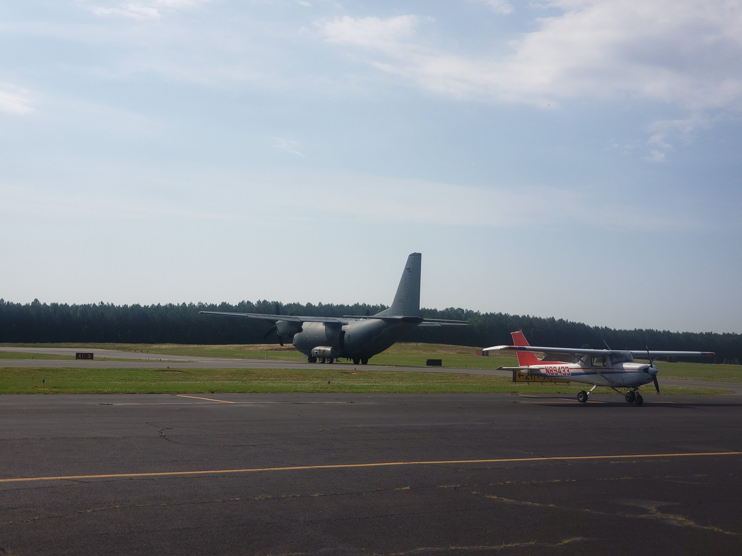
Six letters all together beginning with an N signifies an airplane’s tail number (registered in the US) such as N8080A. The letters there are just like license plates, so you can’t tell what an airplane is by looking at its tail number, although you can by just googling it and seeing if something like FlightAware tells you about it.

On the other hand PA28 is a Piper Warrior PA-28-161 and it’s shortened to PA28 a lot. C152 is a Cessna 152, M20J is a Mooney M20J. I’ll try to be diligent about explaining new airplane model names, but 9/10 of the time I’ll probably be flying the PA28 aka “Warrior.”

ADS-B (I’m lazy and leave out the dash a lot) is this neat new radio technology on 1090 and 978mhz. It stands for Automatic Dependent Surveillance-Broadcast. It’s how you see other planes on ADS-B receivers like my Stratux that I hook into my iPad using ForeFlight. I actually have an ADS-B antenna up at my father’s house that I can track planes with, and upload the dumped data to things like FlightAware, ADSBExchnage, and FlightRadar24. It’s cool!

(EFB) – an Electronic Flight bag (I use ForeFlight). It has maps, directories, weather, weights and balances for airplanes, and much more. It’s super useful and how I record those GPX files that I upload where you can see the maps with altitudes and speeds.

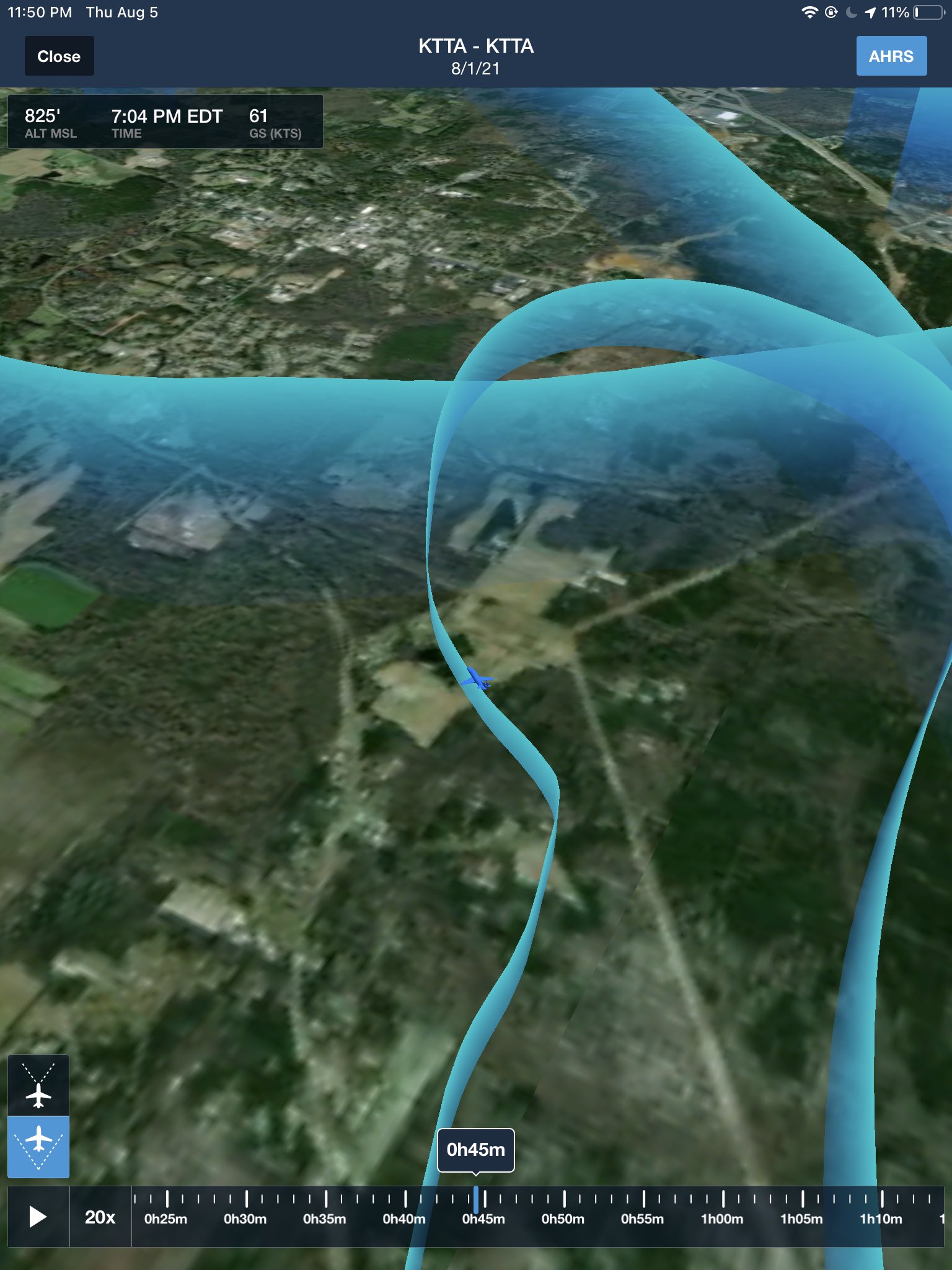
MSL – is Mean Sea Level, meaning if using the sea level as a datum, I am X feet above it, as the average surface of the earth.

AGL is Above Ground Level, pretty simple. But combining MSL and AGL… if I am 1000’agl at KEEN I am 1488’msl, as KEEN is 488’msl, even though I’d only fall 1000 feet if I jumped out.

PTT is push to talk – a term for the button that opens up your radio so you can talk.

V with a letter or two after it, are called V speeds. Such as Vx the speed for best angle of climb, or Vy the speed for best rate of climb. Besides Vx and Vy – the common V speeds you’ll see me talk about are Vr – rotation (lift off!) speed and Vglide (the best speed to glide the furthest distance unpowered).

A B C D E G when talking about air space (no F in the US).
* Class A is anything about 18,000MSL and I’ll probably not talk about that for years.
* Class B is big airports like Boston, or Charlotte – you can see these on a map, they’re usually looking like “inverted wedding cakes” and, except LAX that airspace is wonky looking.
* Class C is smaller but big airports like Raleigh-Durham, or Manchester NH.
* Getting smaller, D is also small airports with towers most of the time (some times the controllers go to bed and you get a class G airport at night).
* Which class G airports are small ones like KEEN, and class G airspace usually goes up to 700agl, 1200agl or capping out at 14,500msl if you’re in the tall mountains.
* Class E is everything else below class A and above/under the other air spaces.

ABCDE – sometimes you have letter mnemonics for remembering checklists, in this case Airspeed,Best place to Land, Checklist, Declare emergency, Execute.

POH – Pilot Operating Handbook, the book that tells you everything the manufacturer wants you to know about the airplane. Charts for calculating take off rolls, wiring diagrams, weights and balances, emergency procedures, etc.

kts – (Knots) – Nautical Miles (NM) Per Hour – unit of measurement, using 1 arc minute, or 1.151 miles.

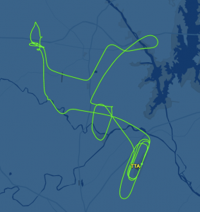
in/Hg – inches of mercury (Hg) – this is air pressure in imperial. 29.92in/hg is the declared standard day, and everything is calculated from there. You get lapse rate calculations (1000 feet of elevation is 1 inch of mercury lower pressure, up to 10,000msl) and your altimeter reads this to say how high you are. (29.92 is 1013.25hPa, for you metric lovers). When flying from airport to airport (or even as you pass by them) you can check the radio to see “well by golly, it was 30.08in/hg at KTTA but out west it’s 30.01, the pressure is falling and maybe some different weather is happening as I seem to be in a different air mass!”

fpm – feet per minute.

VOR – very high frequency omnidirectional range – a VHF radio tower that shoots out directional radio waves that essentially act as a homing beacon to it, so you can know that, for example, you can turn to a heading of 120 and it will point you at the VOR. Used as navigation aid before GPS became prevalent. I love using them, but they seem to be starting to decommission them a lot.

AWOS/ASOS/ATIS & CTAF/Unicom – radio frequencies at airports. AWOS/ASOS/ATIS is the automated weather observation station, and Unicom/CTAF is the common traffic advisory frequency, how you communicate with other pilots (or the FBO)

FBO – Fixed Base of Operations – basically an office that people at the airport work at. Managing the day to day operations of the airport, managing fuel contracts, tie downs, hangars, maintenance, etc.

DPE – Designated Pilot Examiner – the big scary guy who tests you on your license exams.

CFI – Certified Flight Instructor – flight teachers.

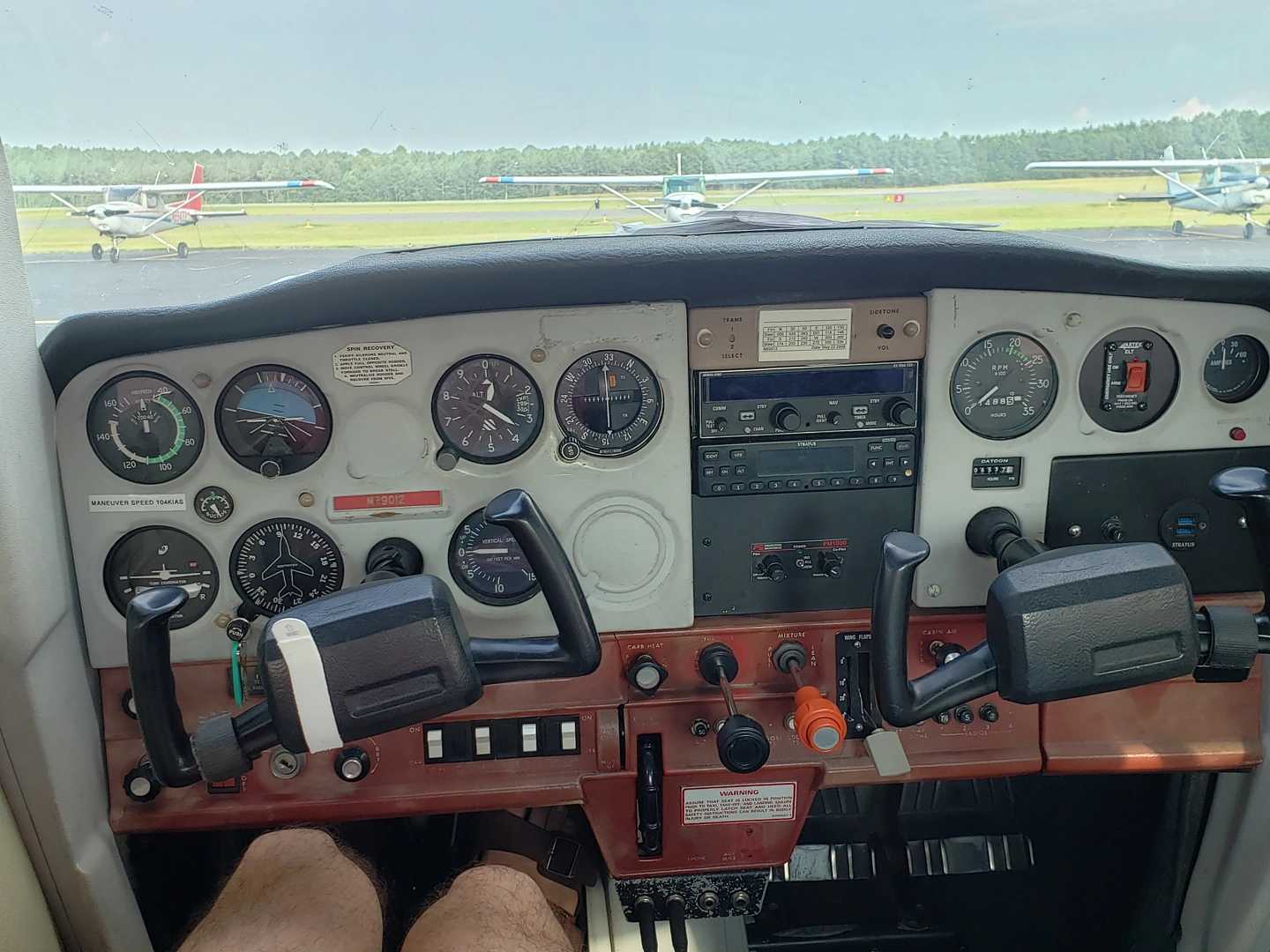
IAS, ALT, VS, HDG – Indicated airspeed, Altitude, Vertical Speed, Heading.

RWY – Runway.

Other random NATO letters like Lima, Hotel, Charlie – these could be anything. Weather at towered airports gives a letter to tell ATC you know what the weather is at the time (“with information uniform”), or could be a taxiway “taxiway Bravo”. Sometimes you’ll see a letter with a number like A2, Alfa-2, this is a taxiway intersection.

Squawk – what a funny word, makes you think of a bird – which it’s obviously based off of. When I Squawk 1200, that means I put 1-2-0-0 into my transponder so that ATC can know I’m flying under VFR at the moment. You can also be told to squawk something like 4203 when ATC wants to make sure they know which plane you are on their radar. If you squawk one of 7500,7600, or 7700 – you better be careful because those are emergency transponder codes. 7500 is hijacking, 7600 is radio problems, and 7700 is all other emergencies like engine out, or fire!

Squawk book – is a log book that you write any problems like “hey my wheel fell off” or “my landing light is out” so that maintenance can fix it.

Trim – there’s a wheel in the plane that you can move to alleviate some of the pressure you exert on the yoke, so you can essentially set a cruise control for the pitch of the plane. In the Mooney apparently it moves the whole tail on a pivot, rather than just a trim tab at the back of the elevator.

Pattern – this is simply the standard “racetrack” shape of how you travel around the runway while in the air. You have the Runway, taking off into Upwind, into Crosswind, into Downwind, into Base, into Final, lather rinse repeat. Usually its a Left Handed Pattern, meaning you take all turns to the left. But some places (or even from ATC telling you) you make them to the right clockwise like at Rutland (KRUT), VT.

Mixture – this controls how much fuel to air ratio is being put into the engine to blow up and keep you moving. At higher altitudes you lean the mixture back (Less fuel! Saves Money!) because the air density doesn’t require as much fuel.

Uncoordinated – this means that you’re not using the rudder to turn as well, on take off if you don’t put in right rudder to counteract the four left turning tendencies, you’ll not stay straight on the runway. You stay coordinated by “stepping on the ball”, in the turn and bank indicator there’s a little black ball you need to keep centered in order to be coordinated. If the ball is too far to the left when you’re turning left – you’re slipping, and if the ball is too far to the right you’re skidding.

Precheck – the walk around an airplane to see if there’s any flaws that you need to be mindful of before taking off. Airfoils aren’t dented, wheels are there for landing, brakes look good, ailerons move properly, etc.

August 8, 2021 – Two flights and some nice weather.

The other day there was a call to action on the Wings of Carolina slack. “Is anyone able to help this pilot get one of our planes back?” Seems this newly licensed pilot, (Congrats!) passed his check ride on Friday and the weather was not great so had to leave N69012 at Asheboro. I said I would be glad to help out if the IFR weather cleared by 9am, I could give him a ride over in N8080A.

I booked a 9am-12pm block, and got to the airport at 8:55am. Grabbed the 80A book book and went to the lounge to check weather. Luckily the fog had burned off and the skies were clear! The pilot met me in the lounge, I wrapped up the weather briefing (nothing of note) and we went out to preflight. The left red nav light was out, but that’s only required at night, confirmed by asking the other pilot. The fuel truck came and filled us up to the tabs (34 gallons) and we were off.

My flight plans were from KTTA -> KHBI (drop off pilot) -> KEXX then back to KTTA. Just under a 2 hour round trip, which took a bit longer because when we got to the hold short line for RWY03, I realized my iPad wasn’t connected to the GPS, so we fiddled with it for a few (no one was behind us, but oof Hobbs running) and couldn’t get it working. That’s fine, we had our GPS and the pilot knew what KHBI looked like form the air. We took off, departed the pattern to the north, got to a little bit higher then turned west.

The pilot was super helpful, having a copilot be able to put in the radios for Siler City as we passed, and the AWOS/CTAFs in for KHBI was actually a really big load off my plate. It’s the little things! Flew at about 3000ft over to KHBI because It was only a 20 minute flight so I stayed low. We get to the airport and he lets me know that RWY24 has a papi, so we chose that runway to land on. Land pretty okay, didn’t grease it, but it is what it is. Taxi over and get him to his plane. I shut down so he can get out safely, then realize after he got out, I CAN’T OPEN THE DOOR. I had to yell him over to make sure I could open the door again, the bottom latch was stuck! I recorded a video, then instagrammed a fellow pilot who is famous in his circles for getting stuck in his plane and having to call someone down in the area who landed and helped him out. Told him he’s not alone, hah.

Anyway, I was able to open the door so I felt like it was okay if I crashed and had to open the door myself. I turn the plane back on, plug in my Stratux for ADSB on iPad, and get ready to take off. I taxi over to the runway (took 24 again out) and hold short for a taildragger and another plane to land. I then take off and woahh there were like 80 birds at the end of the runway at like 300ft up. Luckily I was able to scare them and flew above them, then departed to the right (west) and headed to KEXX. Luckily thr CTAF is the same for both (122.8) so I was able to hear the traffic without fiddling with the radio. I set the AWOS beforehand, so I checked that when I was close, and still winds calm, not bad.

Got 10 miles, out, announced position, 5 miles out, announced I was entering the downwind at a 45. I was on the down when a pilot to my right asked if I was on base, kind of weirded out because I wasn’t so I was vigilant and said I was on downwind (again…). Then called base, and final and landed. Final was neat at Davidson county, had to fly over a factory, which was kind of cool.

Landed, taxied back to the runway and lined up and waited again. The taildragger had followed me! Saw him land as I was at the hold short line. Waited for a jet to land and then off I went! I climbed out, departed to the east, and climbed up to 5500msl. Held 5500 very well this trip, the air was super calm and I’m getting better at electric trim, much easier than just wheel trim.

At one point I turn the auto pilot on, with it set to 109° and 5500msl, but for some reason it made me descend and banked me left 45° and I wasn’t liking that so I disengaged it. I climbed up back to 5500′ for the rest of my trip. By the time I was back to KTTA, the winds still favored RWY03, so I joined the pattern on a 45° entry, and landed smoothly. At around 3000msl descending near Ashbury it was a bit bumpy, but that’s the only turbulence I experienced. Such a nice morning.

Well I get back to the airport and land and shut down… I’m stuck again! Door won’t open. There was no one around I could yell to, so I called the front desk, no answer. I tried again, using different pressures and trying to see if there was like a little latch that didn’t hook. I fiddled for a few minutes and was able to get out, I guess I got it just right.

I then cover the plane, and squawk the door not opening, and posted the video on slack. The next pilot replied to my slack post later that evening that he had no problems. Maybe I’m just door cursed.

Lauren and I then went to lunch before my next flight where I was taking her up in a Cessna 152 (N89333). Well we do the preflight dance, go taxi and take off. At like 300′ above the runway, the damn pilot side door opens up! It’s fine but I don’t want to worry my wife, on her second flight with me ever, so I have her hold the door closed while I go finish the pattern loop (I was doing that anyway). Well MORE fun happened the pilots PTT(push to talk) button got stuck off, so I had to use her microphone to talk, (I could have just switched the plugs, but we were in the base turn). I kind of overshot base so had to over correct a little bit, but we landed okay, taxied back and agreed we were discontinuing our flight. We could have gone back up and carried on – we had the allotted time – but you know what? The rest of the flight wasn’t in the cards.

Total distance: 112.65 mi
Max elevation: 5883 ft
Min elevation: 205 ft

Total distance: 13.51 mi
Max elevation: 1165 ft
Min elevation: 195 ft

August 1, 2021 – Cessna 152 Checkout

Today I got checked out in a Cessna 152. It was really my first time (besides spin training) flying high wing planes and I was a little nervous. We had a pretty standard pre-flight check, took a lot longer than just a “I’m out here to go on a flight”, again because Luke was explaining things to me. There’s a lot of differences like with the warrior, all the flaps are on hinges, but in the Cessna, there’s one pulley hinge and some rollers you need to check, not just actuation hinges. Pointed out how the landing gear is different, there’s plastic fairings that we need to repair quite frequently, and there are no dampeners.

After the pre-flight we took off, Vr is pretty low, at 50 so the plane just wanted to float almost immediately in my opinion. It was also a cooler day outside than my most recent few flights, so that helped too. We took off, headed north to the practice area. I get up to 3000′ msl and we level off, trim for cruise flight and lean the engine. This plane also has a vernier mixture control, so it’s nice to be able to dial in the mixture, even if there’s no on screen display of the gallons per hour like the M20J. There were some clouds at 4000′ I think, but they were tiny, and we figured we didn’t need to go above them, so we stuck at the 3000′ level.

This is where Luke says to just take the plane and do tiny things with it, like turn it uncoordinated, see how much rudder I’d need to do a turn. So I did that for a bit, did a standard rate turn to the left, and we switched to some 30° turns, leveled off then did two 45° turns, back to back. I hit my prop wash at the end of the second one, that always feels great. The first few turns were gross, this plane has old cables for the ailerons, so there’s a lot of play when turning, so it took a few tries to be able to maintain altitude and find that comfortable dead spot with cable tension. The last plane (M20J) I flew, everything was much stiffer for turning.

After the few turns, he said “oh no, there goes your engine” and throttled to idle. I looked around for a place to land, and didn’t see one immediately. One thing I could have done better is look out the back window, because the 152 actually has one! Well I found a spot to “crash land” so I brought the plane to Vglide (60) and slowly descended towards the place to land. I guess in my “everything is okay” did the A B part of the emergency checklist, but I didn’t do ABCDE, so we did it again. This time I:

  • A- pitched for best airspeed (60kts)
  • B- found the best place to land
  • C- Checklist, pretended to check fuel, master, key, primer, etc.
  • D- pretended to switch to 121.5mHz and declare an emergency
  • E- executed the landing, and prepared to exit (opened the door, turn off mixture, etc so the plane doesn’t blow up and I can get out)

and found a cute little field to land in. That was successful so we headed back towards the airport.

At the airport everything was standard traffic pattern. There were three of us in the pattern, one tail dragger that was always just behind us, really friendly guy who liked chatting on frequency, and one low wing – maybe a warrior? – I can’t remember. Well I did six landings. One normal landing, three short field (the last one I did great, landed on numbers and was done before A2 taxiway entrance) and then a few more normal.
Luke said that I was death gripping the yoke, so he did one lap around the airport – where he trimmed and only used his two fingers lightly to move the yoke. Watching him do that, I copied and did a lap around the pattern the same, much easier this time.

We then landed, taxied back and went to park. Parking is WILD, you sit on the tail and then back then walk backwards to get the plane in place. I guess when your plane’s max ramp weight is 1675lbs, that’s easy to do! Three times as much as my motorcycle… After we chatted, he said he feels safe with me flying it, and I agreed. “I feel safe, but not super comfortable, but that only comes with time so I feel safe to take it up and get more comfortable”.

I then had to fill out the quiz, and scanned it, then emailed it to him.

Total distance: 126.39 mi
Max elevation: 3709 ft
Min elevation: 228 ft

July 25, 2021 – Mooney M20J checkout… sort of

Tuesday night I emailed my instructor saying “Hey the Mooney is available Sunday afternoon, could we start getting me ready for a checkout”, and he said “sure, book it”, so I did. Then last night I started reading through the POH. There’s a lot of neat differences. Cowl flaps, retractable landing gear, constant speed prop. I definitely wanted to start getting my complex rating. I read through that POH, and look up a lot of videos on how to work the prop. I’m used to just throttle and mixture in the Warriors, but this has throttle, manifold pressure, and mixture levers. I learned the cool parts about how the oil pressure, and springs set the propeller angle.

So I get to the airport at about 1pm, and we start talking about what I know. I explained how the undercarriage stuff works, under 132kias for lowering, and under 107kias for raising, and learned from Luke that there’s two different speeds because of gravity and fighting gravity. We spend the first hour talking about why you need different manifold pressures. Then we head out to the plane and do a very comprehensive pre–check. I learned that the M20J doesn’t have a trim tab, the whole tail raises and lowers on a pivot, NEAT! The flaps are suuuper wide and the ailerons are kind of thin. The landing gear was an interesting inspection because of how the poles and hinges open/close the gear.

After the pre-flight we get flying. Things are pretty similar on the ground, as the propeller lever is pushed all the way forward, and the throttle is the main control. Luke points out that the propeller is rounded, so there’s an RPM range that you shouldn’t idle in, (1550-1950ish), vs the squarer prop that the other Mooney had.

We take off, and one thing I check different is if I have available runway left, and when I don’t, I can raise the landing gear at that point. It was pretty cloudy, so we had to climb up to 5500′, and eventually we hit 7000′ to jump over some clouds. First time really being above clouds this much, for the first hour we were over them. For the climb out he told me to set the plane to “twenty-five squared” – 2500rpm and 25in/hg. And every so often I would need to add more manifold pressure because of the atmosphere lapse rate while climbing.

We got up to 6000′ ish, initially and then did some straight and level flying, super smooth above the clouds today. Then we did some 30 degree turns, did a few of those okay. When we did 45 degree turns, my first left one was kind of bad – lost a lot of altitude. One to the right was okay, and then the third one to the left I kept my altitude right.

After turns we did slow flight, and it’s pretty much the same controls. The power off stalls I was I guess putting in unconscious left aileron, because we kept starting to spin a little to the left, next time I fly I definitely need to practice that more.

Well we ended up going pretty far east, at one point we were like 15 miles southeast of RDU, felt uncomfortable not talking to anyone there, but I guess it was out of the normal flight path for the jets so we were fine.We ended up needing to head back to the airport for 4pm, so I put the plane in a 750fpm descent while heading back, at one point I was able to punch through the clouds at around 2500′, and we joined the traffic pattern on the 45 for downwind on 21. I landed VERY well he said. He said that people transitioning from Warriors to Mooneys land hard because the M20J is a lot lower of a plane than the PA28, so they flare early and land hard. I didn’t flare early both times we landed so he said we could just end for the day. I always love when instructors say I do well with landings!

We then get back to the airport to do some payments and find out “Oh, Tyrel needs 250 hours without an instrument rating, to fly the M20J, or 150 with an instrument rating.” So Oops, I guess it’ll be a while before I can rent this, and get an actual check out.

Total distance: 169.41 mi
Max elevation: 7036 ft
Min elevation: 227 ft

July 10, 2021 – First flight with Dad

[Writing this July 26th, I’ve been busy traveling and with visitors]

I actually did a flight on July 7th, but It was only one lap around the pattern. It was 95°F here, and I knew I wouldn’t be in the right mind to continue my flight as I got to the traffic pattern after take off, so I just called crosswind, and headed back to land, a whopping 0.3 hour flight time! So that’s what just one melting traffic pattern loop looks like!

Anyway! My father was excited to fly with me, we took N2114F up. We intended to go from KTTA-SDZ-KRCZ, but it was still hot, so we decided to just do SDZ and back.

We take off, and do one lap around the pattern – I want this to be my standard when I bring new people up, it gives them a way out to say “GET ME OFF PLEASE”. After that one pattern lap we headed towards SDZ. It was a really smooth flight, we flew at 4500 feet to the VOR, then tried to get to 7500 feet on the way back (We had time, I wanted to climb) but it was just SO HOT that we ended up just staying at 5500feet, the climb was taking forever!

When we were 10mi from the airport, it started getting super busy (BBQ day at the airport!), so we decided to waste some time in the practice area and I did a steep turn for him to waste more time. After that the traffic died down so we headed back to KTTA. I did a touch and go, a regular landing, and then being that there was no other traffic, practiced an emergency engine out procedure (what I failed on my checkride) and that went smoothly.

So nothing super special about this trip, besides it was my first time flying my father.

Total distance: 132.84 mi
Max elevation: 6960 ft
Min elevation: 200 ft

June 14, 2021 – First flight with Lauren

Today was my first flight with my wife, Lauren. She is my first real passenger (“technically your DPE is, blah blah”). I didn’t know what to expect, I knew she had been up in planes before – she’s gone skydiving, something I will probably never do. I’d rather be the person to fly the “JUMPERS AWAY OVER X” than be a jumper. I don’t want to make this entire blog about Lauren, although we all know I could. So I will try to keep it 50% airplane talk!

We scheduled a 12pm flight, with an estimate of me probably taking off at 12:30 (took off at 12:40 for pattern and 12:49 to KDAN), Cross country from KTTA to KDAN and back to KTTA. I wanted to fly at 4500’msl there, and 5500’msl back, following the East is Odd +500 and West is Even +500, because it was a 358°ish flight there and a 178°ish back (that’s from airport center to airport center, but I did some cloud avoidance, a few times (like, the whole time) so I was pretty off course, but ForeFlight will get me there. I brought my Stratux because I remembered that N8116J didn’t like bluetooth and ADSB so my iPad wouldn’t connect to the plane. I also bought a new GPYes unit that I wanted to try out, and it worked great, no more magnetic GPS sticking to random magnetic things, everything is self contained in my Stratux!

Wind was good for RWY21, so I had to taxi via Taxiway Alfa to get there, still not a fan of how Wings of Carolina has us do a runup off the taxiway, something I need to get used to at a busier airport than KEEN. Well, we took off and I did a loop of the pattern – I wanted to gauge Lauren’s stomach, and my flying abilities to make sure she was okay to fly. The Pressure Density was 2,800′-2,900, which for a 255’msl runway, oooof. After the second takeoff we flew out to the traffic pattern then departed to the north! We climbed up to 3000, the cloud layer was about 3800 so I chose to stay under it, vs fly over the top and chance not having an opening. It was pretty bumpy – there’s a convective SIGMET over like the whole east coast – so I knew it was going to be a little bumpy. Lauren was taking pictures the whole time (she took 47! I’ll share some) and got some fun ones of me. In my pictures I look like I’m super concentration face, but she got a couple of me smiling.

Nearing KDAN I realized that the CTAF was Actually a CTAF (Common Traffic Advisory Frequency) and that KDAN had a tiny little tower. I called 15 to the south (because I heard a lot of traffic) and the nice person on the frequency came in and said something like 16J there’s two planes on the taxiway, one in the pattern and one just departing, which now I understand why people come on our Unicom back at KEEN and keep saying “KEEN Unicom please advise”. Well we got closer I said I was flying over midfield to make a tear drop into the downwind. I did as such, flew over at 2500′, did the tear drop, down to 1500′ and landed. We then taxied to the FBO and shut down [my outside camera picked THREE seconds after I shut down to die, perfect timing]. The nice ramp assistant gave us a ride to the FBO in the golf cart so we could pee.

Gatorade passed through our system completely we headed out to the plane. We got some weird looks from the people chilling in the FBO (Enterprise people, and like a grandfather? idk) for wearing masks. Yes we’re both vaccinated, but I sure as hell don’t know if the random people I run into are, gotta keep you safe!

We took a few pictures, and then went and started up the plane. When I was doing my run up, I didn’t have the mixture full rich, was still leaned for ground ops, so when I did the mag drop I heard a backfire, was like OH SHIT and realized I was leaned. Put in full mixture, and did the mag drops again, ~150rpm loss and we were good to go. Lesson learned here is even if there are shortcuts for when the engine is hot, and you just land for 10 minutes, probably good to go through the full checklist even just skimming it.

We took down taxiway Alfa again and got to RWY02. Side note, KEEN has 02-20 and 14-32, this airport KDAN has 02-20 and 13-31 so when I came upon it, I was like “holycrap I feel like I’m home”. Anyway – when we got to the end of the taxiway there were two entrances only like 100ft apart to the runway, it was weird. We had to wait like 10 minutes to take off, because there were 4 planes doing touch and goes and they were perfectly spaced to give me like NO time to take off. I know how long of a runway I need to be safe, but with a 2900′ Density Altitude, I know I needed a longer ground roll, so finding time to slip in to where I knew I could take off was annoying. Finally one of the guys on downwind said “Plane waiting at 02, I’m extending my downwind a little bit to give you some time to take off, so I rolled out, thanked him and took off to the north a bit. I extended my upwind and gave the pattern a large buffer, then took off to the south.

Lauren seemed to be getting tired by like 75% of the trip back so maybe next time I’ll take the plane for four hours, and then we can take a full hour between legs, instead of 15 minutes. I did three hours, because I planned for a longer break between – we even bought zucchini bread I made last night! – but I threw in that extra pattern lap before we left the airport, so that added like 15 minutes, and I couldn’t find the flight book so that took some extra time.

When we were on the way back to Raleigh Exec, we saw another plane like 500′ below us so I flew above them and circled past them then tried to come in behind them but I have no idea where they went when I flew over them, my ADSB decided to not pick them up, so I did a larger right turn so I knew I’d avoid them. It was weird and I’ll have to check FlightRadar24 playback to see – but it’s not up now for some reason. After that steep turn I entered the downwind and landed. We landed with 2 minutes to spare, but it took a few minutes to shut down, and tie down. Glad someone wasn’t right after us (if someone was I would not have gone as far of course). Covered the plane, paid the $260 for 2.3 hours of flying, put the book away and headed home.

The return trip took about exactly the same length. We left KTTA at 12:49, landed at KDAN at 1:36 (49min). Then with waiting for takeoff, we left KDAN at 2:07 and landed at 2:57(50min). On the flight back, it was a bit bumpier, the clouds were still scattered at about 3800 but some were darker than others so I flew around them. I wonder if when I finally fly IFR if I’ll fly a lot straighter, instead of just “oops avoid that cloud!” that remains to be seen.

Some attachments today are the airport charts for KTTA and KDAN, as well as a fun youtube video of the first leg to KDAN. Two GPS recordings (ADSB FINALLY!) and hopefully a small gallery of Lauren and I. (Link to all photos will be at end as well)

Total distance: 100.51 mi
Max elevation: 3125 ft
Min elevation: 200 ft

Total distance: 101.44 mi
Max elevation: 3293 ft
Min elevation: 210 ft

June 7, 2021 – Final Checkout Ride

I can finally rent planes through Wings of Carolina! Flew today and the CFI passed me.

I was a bit nervous about the North Carolina weather so I text the instructor to see if we could leave an hour early for the controlled airspace portion of the checkout. He said let’s shoot for 3:30, we took off at 4 because he gave me a bit of ground instruction on the systems in N8116J. (Also we couldn’t figure out the radio, so had to push a few buttons to get comms working. It seems when 16J was in the shop, they had undone all the COM1 COM2 selection buttons, which caught us off guard.)

We took off, then flew south to Fayetteville (KFAY), Luke showed me the auto pilot, how to climb, descend, turn to a heading, so we enabled that on the flight to KFAY. 20 miles north, called approach, I fumbled my radio A LOT. I definitely need more controlled airspace practice. ATC Talks FAST. It’s hard to fly the plane and copy things down, I think I need to start using a pen and paper, not Foreflight for ATC remarks, it’ll be much easier. I put a FieldNotes book in my flight bag the other day, time to use it! After a few more fumbles (I copied back the altimeter, not the altitude, talk about stress!) I was cleared to land. Squawked 0210 and landed on runway 22 almost straight in, I took a right handed base, it was weird! There were no commercial flights so they were at a lull of traffic which is why I just got the RWY22 CLEAR TO LAND. Unfortunately (or Fortunately..) LIVE ATC and KFAY approach are down so I have no recording of my fumbles. Would have been nice to hear them again so I could learn.

We landed, taxied back to runway 22, and then said we were taking off VFR. Squawked 0212 now and departed, stayed runway heading until they said turn right heading 320 staying at or below 2500. Then a bit later they said fly flight plan heading I turned 355 and then we finally got out of their airspace. There’s two airports there, KFAY and Simmons Army Airfield (KFBG), so their airspace looks like a cell dividing, two round circles and of course we bisected it the long way.

Out of their airspace Luke said “I have the controls”, then banked hard 60 degrees right, and pointed down. He said “If you’re ever VFR and inadvertently hit IMC weather, and get into an unusual attitude, hit this button [LVL] and presto, the wings will level.” which of course they did. Auto pilot is still wild to me, I never flew with it in N43337, so it’s going to take a lot to get used to, but I’m sure I’ll start loving it.

We then called 10mi on the 45 for RWY22, did a touch and go, (I came in a little higher than I wanted I still need to learn the sight pictures for this airport, but oof it’s FLAT still.) took off did the pattern once more and did a full stop.

On this flight, I learned the GPS a little bit more, the touch screen menu will make selecting comms so much easier, glad they have these consistently in all their planes. I also learned AutoPilot, I need to find a flight sim model with this auto pilot (I did get a Logitech/Saitek Multi Panel with AutoPilot on it this weekend, so good timing!) that I can learn how the IAS, ALT, VS, HDG buttons work better. HDG and ALT I get, those just hold heading and alt, but airspeed and vertical speed climbs are still magical!

Luke then signed me off, so I’m clear to rent any of the PA-28-161 that they have at Wings of Carolina. I told him I want to learn how to fly the Mooney M20J soon, I’m excited to get my complex endorsement.

Here’s some radio clips of me in the KTTA Pattern, just for fun.

(The profile there is wrong, but the track is right, so something was funky with FlightAware. the Bluetooth on 16J was broken so I couldn’t foreflight. Seems this is endemic in the WOC planes, so I might keep bringing my Stratux just for my logging)

Wings of Carolina Check out
100%

May 27, 2021 – Second flight as PPL

I was able to sneak in a cooler morning flight in N8080A. I took my motorcycle to the airport, but forgot my yoke mount so I was iPad-less. We had to wait for a long while to get fuel because the services truck was filling the HU-16 that had arrived a few days beforehand. There was also a C-27 taking off, super cute, Feels like a baby C-130!

We went up, took a few minutes to do another 45° bank turn. I did that a little better, less shaky. Then he had me practice some emergency descents. I didn’t do as well at those as I should. I need faster ADM skills. That will come with time, one of my big weaknesses is emergency things, so it’s one thing I’m excited to start practicing.

After the emergency procedures, he had me practice rudder control. Putting in enough rudder while turning to hold on target before the turn and rolling out while pointing at a target – but rolling out. I’m much better at rolling out than rolling in, so I’m excited to have a new procedure to practice. One of the things I like a lot about this CFI giving me the checkout to borrow planes, is that he’s young. He doesn’t have these really old ways of thinking about things and I appreciate that.

After the higher altitude stuff, he wanted to see some short-field landings. The first time in the pattern we had to extend our downwind A LOT, there were three people on long finals, so our downwind was funky and long. I’m still getting used to this plane and the runway so by the time we were about to touch down, the other plane in front of us was still on the runway (albeit turning onto taxiway A3 a mile down the runway) so he said go around, as technically the other plane was still on the runway and things could go wrong even with that far separation.

Did a go around and the next two short fields were okay. We got off at Taxiway A2 I think, and then took taxiway A back to the ramp. When we got to the intersection with A and A1 there was another plane getting ready to cross the threshold, but it was a Cessna 172… high wing! They didn’t notice that there was a taildragger apparently norad coming on a 45° final, not straight in and almost rolled into the runway. Luckily the CFI I was with shouted STOP on the CTAF and they stopped, seconds before an incursion! EEEEK!

Wrapped up, and planned our third checkout ride, it’ll be down to KFAY, a controlled field. Should be on June 2nd and then I’ll be cleared to rent the planes and feel like a full member of the Wings of Carolina!

Unfortunately no GPX file, but I have a screenshot.

Screenshot of flight path.

Wings of Carolina Check out​
Wings of Carolina Check out 66%